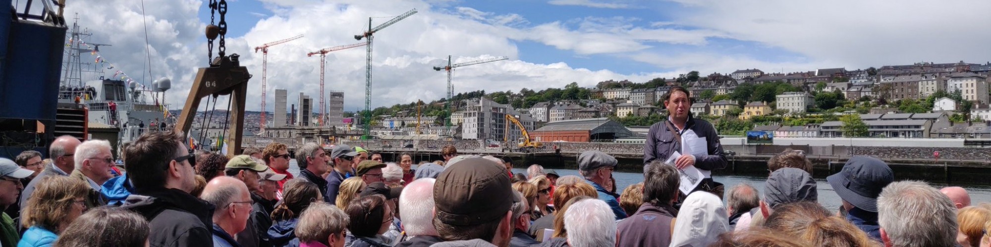
Walk begins at City end of The Marina.
Below is a brief historical walking trail, which covers some of the topics on my physical walking tour. The information is abstracted from various articles from my Our City, Our Town column in the Cork Independent, 1999-present day, Cork Independent Our City, Our Town Articles | Cork Heritage
As an alternative to reading the trail, take the audio history trail, which was developed with Cork Harbour Festival in 2021, History Trail, The Marina Audio Trail | Cork Heritage
Introduction:
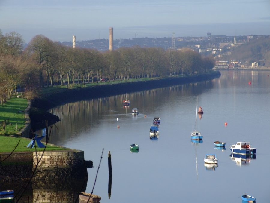
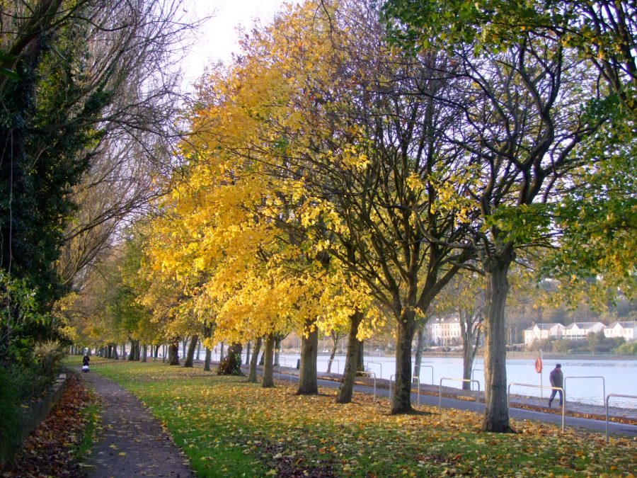
A stroll down The Marina is popular by many people. The area is particularly characterised by its location on the River Lee and the start of Cork Harbour. Here scenery, historical monuments and living heritage merge to create a rich tapestry of questions of who developed such a place of ideas.
Where not all the answers have survived, The Marina is lucky that archives, autobiographies, census records, diaries, old maps and insights have survived and give insight into how the area developed. These give an insight into ways of life and ambitions in the past, some of which can help the researcher in the present day in understanding The Marina’s evolution and sense of place going forward.
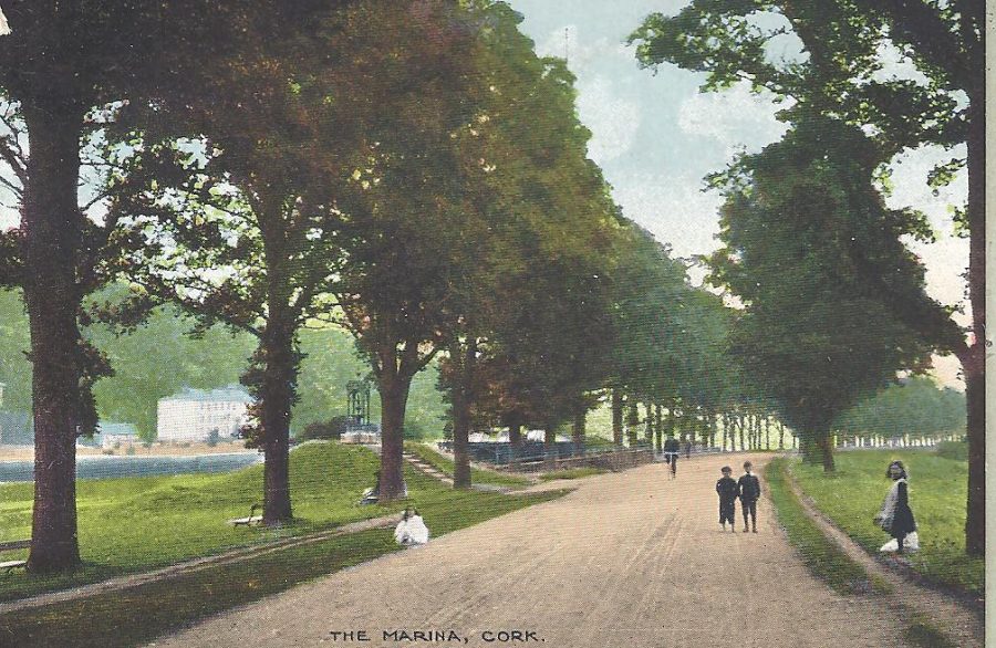
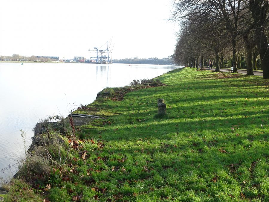
From Navigation Wall to Marina Promendade:
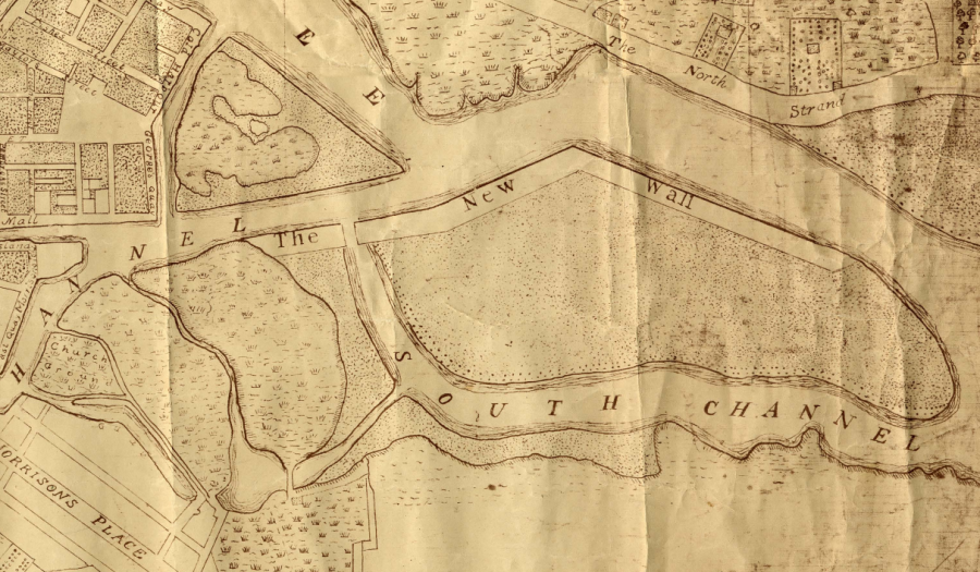
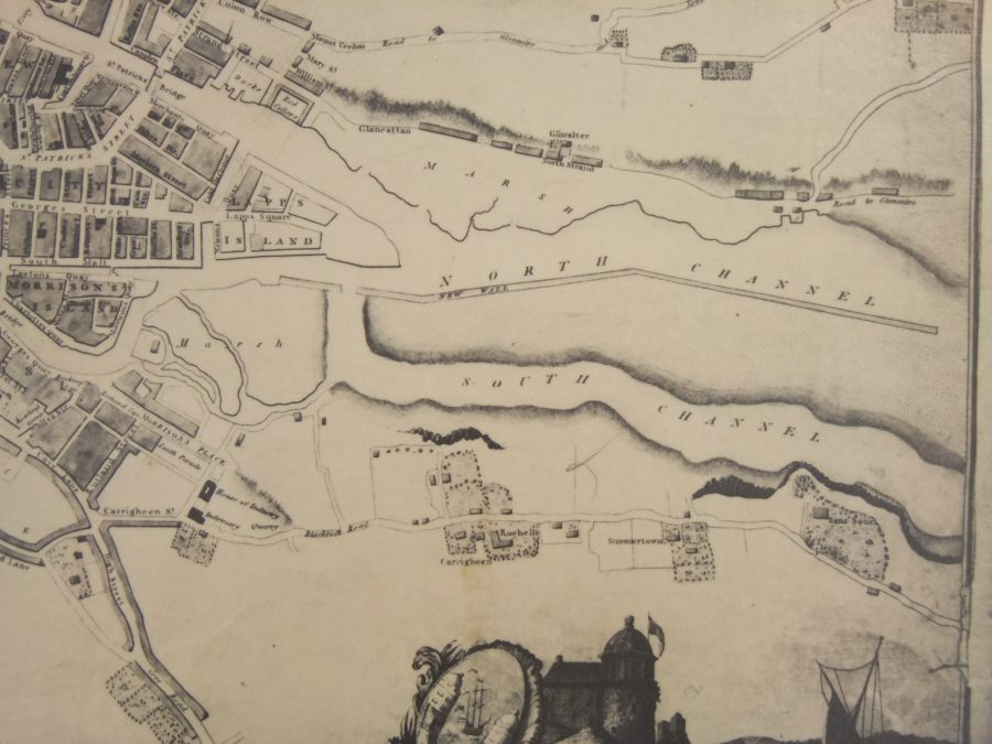
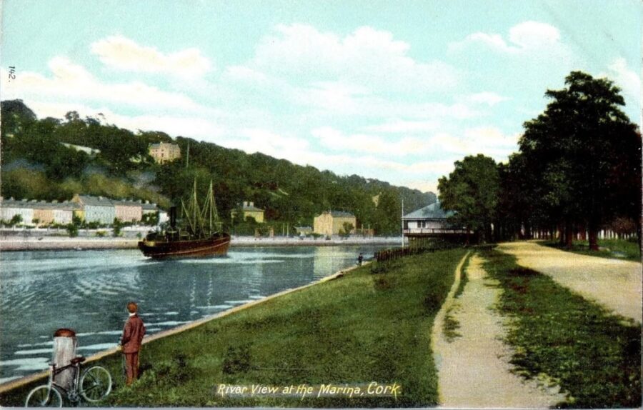
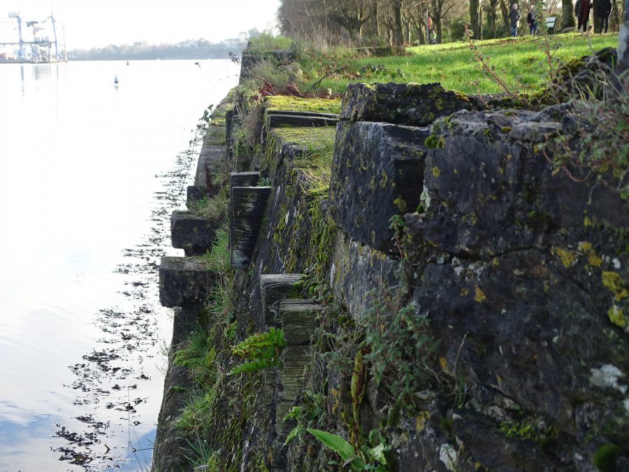
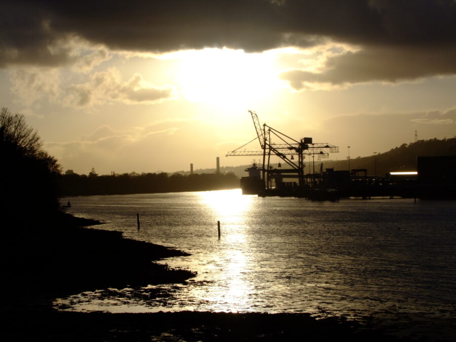
Cork’s Marina was originally called the Navigation Wall or in essence it was a guidance or tracking wall to bring ships into Cork City’s South Docks area. It was completed in 1761.
The dredger of the Cork Harbour Commissioners deposited the silt from the river into wooden barges, which were then towed ashore. The silt was re-deposited behind the Navigation Wall.
(source: Cork City Library)
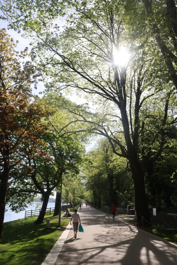
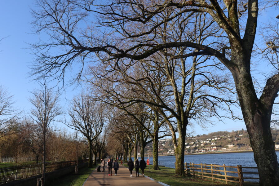
During the Great Famine, the deepening of the river created jobs for 1,000 men who worked on widening the physical dock of the Navigation Wall. In essence a fine road was constructed, which linked into Cork’s South Docks. To give an aesthetic to the new road, a fine row of elm trees was planted c.1856 by Professor Edmund Murphy of Queen’s College Cork (now UCC). The elm trees were part of a crop and tree growing experiment.
In 1870, the Gaelic poet and scholar Donncha Ó Floinn, based in Cork City, put forward to the Improvements Committee of Cork Corporation that the new road of the Navigation wall be named Slí na hAbhann, which means the ‘pathway by the river’. Ó Floinn’s proposal was not accepted. The matter came before the Improvements Committee again in 1872. This time Ó Floinn suggested that the promenade be named ‘The Marina’. He outlined that ‘The Marina’ was the name allocated to a recently reclaimed piece of land near Palermo in Sicily. In July 1872, Cork Corporation formally adopted ‘The Marina’ as the name of the new road or promenade.
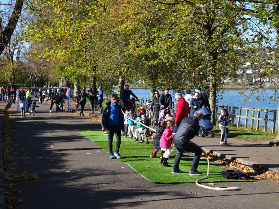
In 2018 The Marina was chosen as a test bed for creating playful streets. Cork City was selected to be part of an EU URBACT transfer learning programme Playful Paradigm. Udine, a city on northern Italy had been using play for over 20 years to support the work of its municipal council and had also analysed the impact of this way of working with its local university. As a Healthy City, it had also used play to engage with hard to reach communities. Along the way it devised a series of playful interventions and these were shared with the participating cities.
In 2018 Cork Healthy Cities noted “Cork had at that point no formal culture of play or an understanding of its potential as a level for societal change. A diverse steering group was required for participation in the project. A public forum was created to launch the project and invite participation. 100 people from across the city attended the Play forum and from this the steering group was formed”.
One of the acclaimed programmes of the URBACT Playful Paradigm project was the weekend pedestrianisation of the Marina for family play days
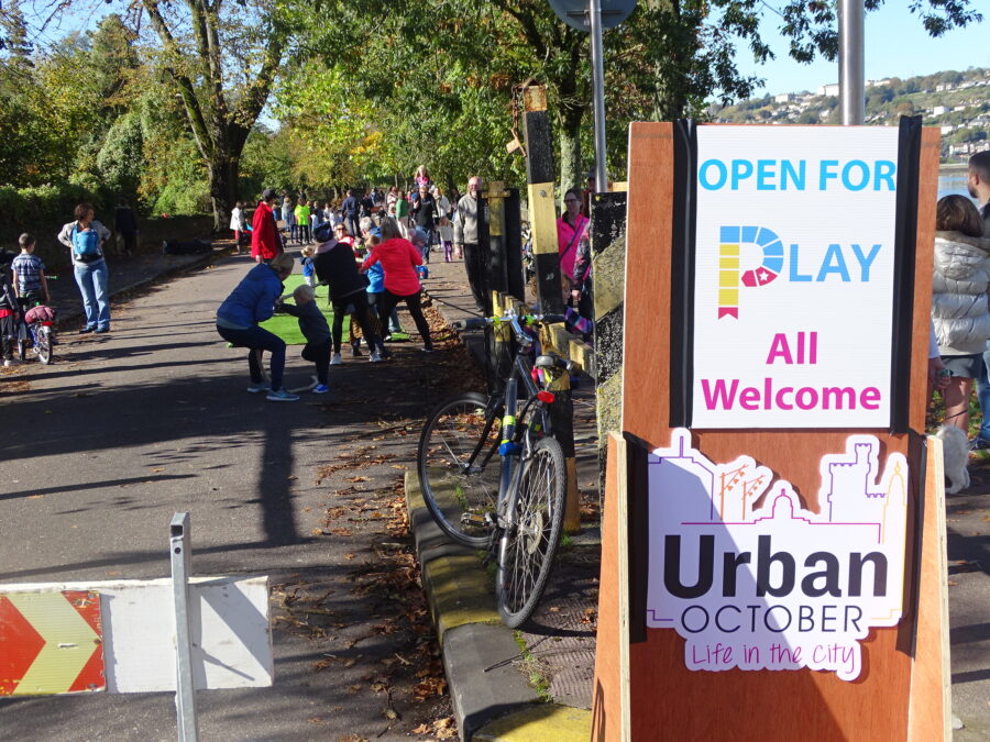
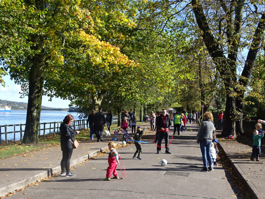
Inspired by the Playful Paradigm, in May 2020, as part of its plans to deal with COVID-19 conditions, Cork City Council pedestrianised the Marina for three months on a trial run. The pedestrianisation of the Marina was just one of a range of measures being put in place by Cork City Council to facilitate social distancing in the city and “support the health and wellbeing of residents and workers, ensuring public confidence and awaken economic, social and commercial life as we live with COVID-19”.
In cities across Europe there was emerging evidence of the reallocation of additional road space to walking and cycling in the response to the COVID-19 pandemic. Allocation was increasingly being pursued as the best available option to safely facilitate the movement of a considerable volume of people to work, education and amenities.
In the winter of 2020, public consultation by Cork City Council began on a full pedestrianisation of The Marina. It was agreed to permanently pedestrianise The Marina from 1 January 2021.
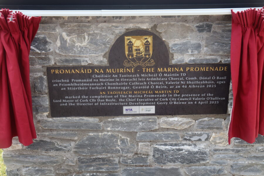
In late 2023, construction of the new Marina Promenade started and finished in late 2024, delivering a 5.5-metre-wide pedestrian and cycle corridor complemented by adjoining plazas, connections to Marina Park and other features.
The 1.8km long new amenity space extends from Centre Park Road to Blackrock Village and features age-friendly seating, riverside viewing balconies, enhanced landscaping, environmentally sensitive public and feature lighting and other features.
The adjacent historic stone walls along the promenade were cleaned and restored, while the formal tree planting was carefully preserved. An array of new vegetation now lines the walkway, with approximately 60,000 bulbs now coming into bloom and 34 newly planted trees.
The revamp of the Marina Promenade aligns with the ambitious redevelopment plans for Cork Docklands, one of the country’s largest regeneration projects. Phase 1 of Marina Park consisting of 14 acres was opened in 2022, with Phases 2 and 3 consisting of an additional 56 acres now expected to be open to the public in late 2025.
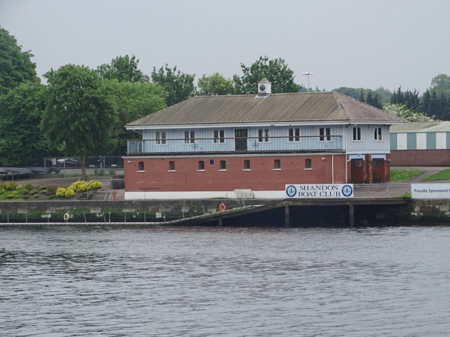
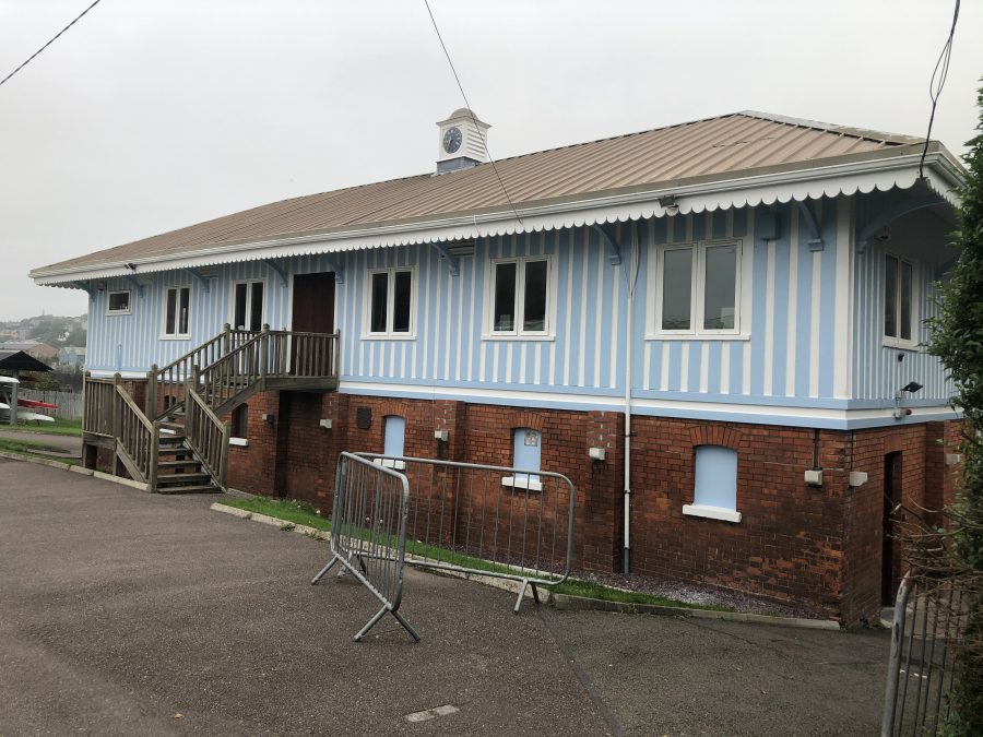
Shandon Boat Club:
The lineage of Shandon Boat Club – although founded in May 1877 – stretches back to the beginning of organised competitive amateur rowing in Cork twenty years earlier. In 1858 Cork Harbour Rowing Club (CHRC), was founded. Ten years later, in 1868, Queens College Rowing Club was founded by a number of members who left CHRC after a dispute and nine years later that club changed its name to Shandon Boat Club, due to the lack of “college men” rowing with the club by that time.
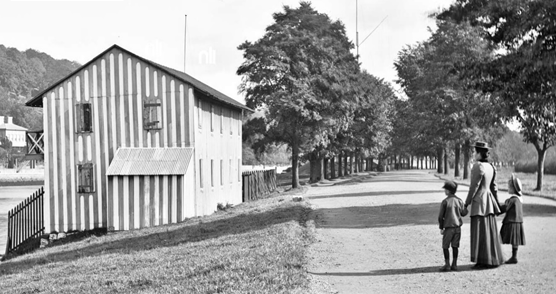
In 1871 Cork Corporation granted land to Queens College Rowing Club to build a boathouse on the Navigation Wall of the Marina and this boathouse was subsequently knocked and replaced in 1896 by the building still in use today. The new building was designed by the well-known Cork architect, James McMullen.
The practice of James McMullen’s was a varied one, including ecclesiastical, hospital, industrial, commercial and domestic work, primarily in the city and county of Cork. He was architect to the South Infirmary, Cork, for some thirty years and was appointed local engineer and valuer for the Cork Junction Railway in 1904.
Some of his largest and best known works apart from the Honan Chapel include Marina Flour Mills on Victoria Quay (1890-92), the Eye, Ear and Throat Hospital on Western Road (1895-97), the Fr Mathew Pavilion Museum at the Cork International Exhibition (1902), additions to the sanctuary for the Capuchin Fathers at Holy Trinity Church (1906) and the restoration after destruction by fire of Castle Freke House (with architect, Kaye-Parry & Ross) in 1910-12.
READ MORE: Check out Shandon Boat Club’s website, Shandon Boat Club – Shandon Boat Club
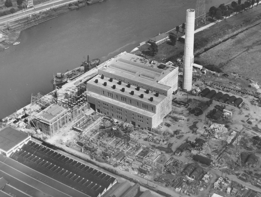
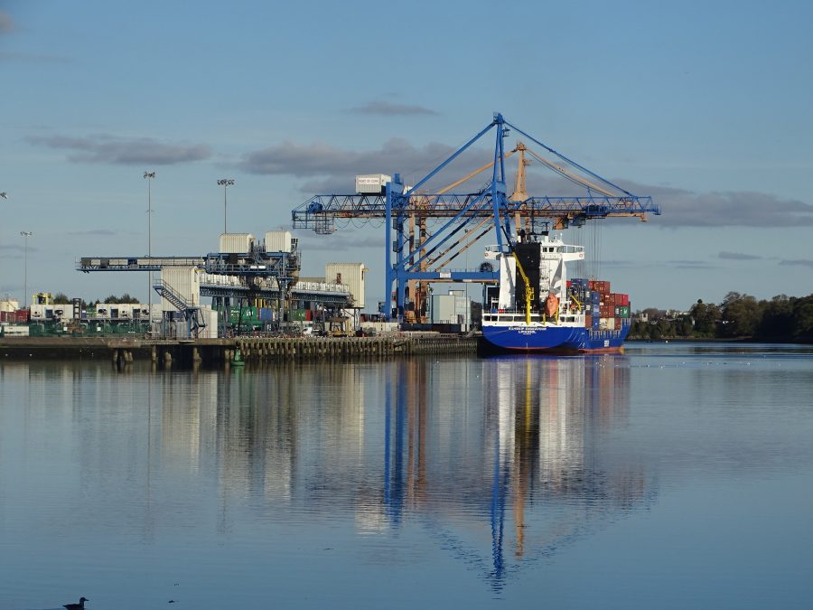
ESB Marina:
The second of the ESB’s led projects in 1950s Cork was that that of the steam powered station on The Marina (first being the Lee Hydroelectric Scheme). Irish industry showed an overwhelming preference for electric power because of its availability, economy and convenience.
Up to the late 1940s, power came from Ardnacrusha, Pigeon House on the Liffey, and Alleywood or Portarlington. In the event of Ardnacrusha not operating for any reason, power had to be transmitted over long distance, which, experience had shown was an unsatisfactory arrangement. Before World War II, this possible difficulty was foreseen and plans were laid by the ESB for a Cork station. Owing to immediate post-war difficulties the preliminary work could not be undertaken until 1950, and the near completion of such a big undertaking in such as short space of time represented a notable achievement in its day.
Construction of the Marina station began in 1951. Operating from 1954, it fed electric power into the national network for use in homes, factories, streets, highways and farms throughout the south of Ireland. The station was the seventh power station to go into operation since the end of the war.
The now decommissioned Marina Station occupies (still does) a commanding location on a 13-acre site facing Cork quays. Surrounding it at one time was Messrs Henry Ford and Son’s Motor assembly works, Dunlops Ltd rubber factory, the towering silos of the Cork Milling Co Ltd and National Flour Mills Ltd.
VIEW 1954 promotional material here: marina-pr-pamphlet.pdf (esbarchives.ie)
READ: News story on closing ESB Marina: ESB’s Marina power station facing closure (echolive.ie)
News story on closing ESB Marina: ESB’s Marina power station facing closure (echolive.ie)
Caretaker’s Lodge:
On 11 May 1883, Cork Corporation proceeded to appoint a qualified person to the position of Caretaker of the Marina at a salary of 15s per week, with residence, fuel, and uniform clothing. The first caretaker was Denis Murphy who gave 30 years of service. The stylish lodge that was constructed for the caretaker between 1890 and 1900 was present until the 1970s before its demolishment. Its location was adjacent Shandon Boat Club.
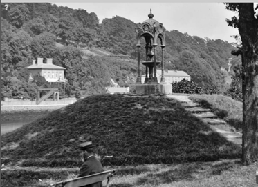
The Drinking Fountain:
At the city end just outside Shandon Boat Club is a grassy mound on which a long time ago stood a drinking fountain, which was donated by Cantillan family. Very little of its public history has been recorded. The remains of it are still there – the square concrete base, the four cast iron columns, which supported an artistically designed jet through which water once gurgled. Like several other old historical features on The Marina, it could make a great craft piece if recreated. It’s gone past the point of no return at present.
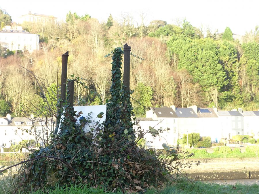
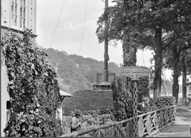
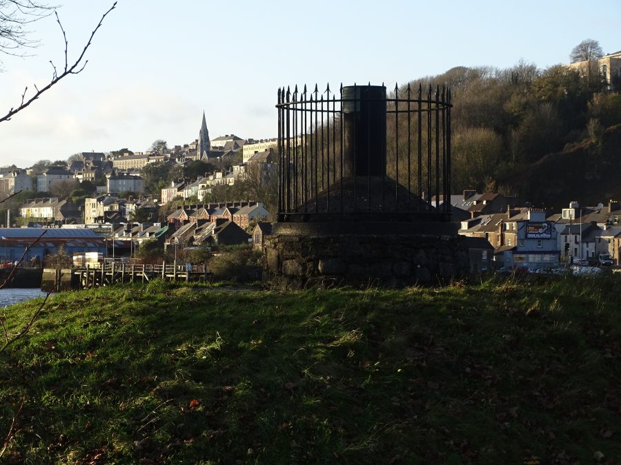
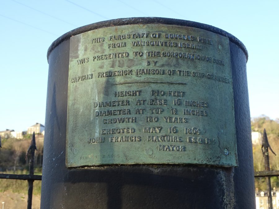
The Captain Hanson Flag Pole:
Adjacent the Cantillan fountain is another grassy mound topped with a conical concrete base surrounded with ancient rusting iron railings. Inside the railings is an equally rusting iron cylinder with an inscription describing an old symbolic flagstaff or flag pole.
The inscription reads: “This flagstaff of Douglas Pine was presented to the Corporation of Cork by Captain Frederick Hanson of the ship Grange – Height 140 feet; diameter at base 16 inches; diameter at top 11 inches; growth 180 years. Erected May 16 1864 – John Francis Maguire, MP, Mayor”.
An old c.1910 picture shows the extent of the flagstaff or flagpole. A few decades ago, the full flagstaff succumbed to time and was taken down, just leaving the inscribed base.
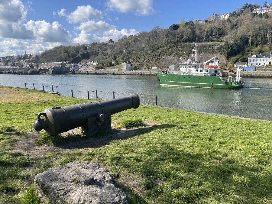
The Sebastopol Gun:
Adjacent the former Captain Hanson Flagstaff mound is an old iron canon gun from the British Siege of Sebastopol on the Black Sea in the late 1850s. It was captured as part of the Crimean War. The mound was originally flanked by two old guns mounted on wooden carriages.
The guns were originally installed at the junction of the South Mall and the Grand Parade, to embellish the equestrian statue of George II. When the statue was destroyed in 1862, the guns were moved to The Marina. The second gun is now missing as is the wooden carriage of the remaining gun.
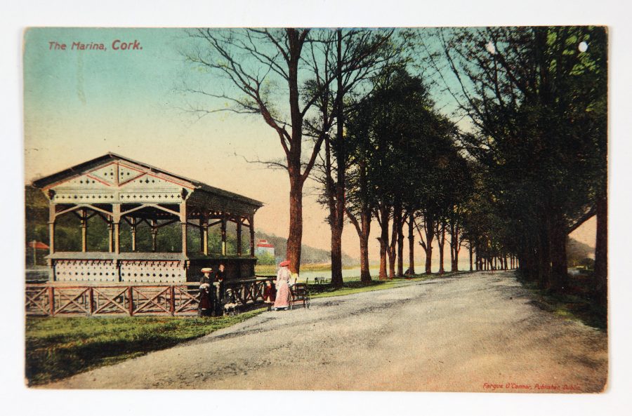
Band Stand:
For many years up to the late twentieth century, music could be enjoyed from the band stand on The Marina. The first of the evening musical soirees were established by the Mayor Francis Lyons and took place on 21 June 1866.
The Cork Examiner reported on the 21 June event the following day (p.2):
“The evening was delightfully fine, quite worthy of a midsummer day, and some thousands of respectable persons, including many of the working classes, availed of the proposed treat. A German band had been engaged for the occasion, and performed in the new orchestra stand, now nearly completed, which has been erected for the accommodation of bands on the Wall. The new flag of the Corporation – a green banner, displaying the Cork Arms, in gold was hoist on the handsome flag staff, but the light evening breeze scarcely sufficed to display it”.
“The path was in excellent condition for promenaders; and altogether, the appearance of the New Wall embraced much of the picturesque. The amount of healthful enjoyment conferred on thee citizens by his Worship’s simple contrivance, is scarcely to be estimated. It is right to add, however, that the quality of the music was not quite what many of our rather fastidious citizens would have admired”.
The bandstand also fell victim to decay and ruin and was dismantled at some point a good few decades ago. If anyone has info on this let me know.
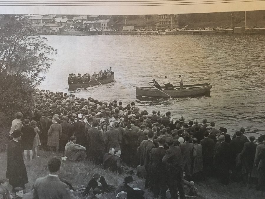
O’Shea’s Ferry:
In the early twentieth century, there were four ferries in Cork City across the River Lee: one from Sunday’s Well to Ferry Walk, one from St Patrick’s Quay to Anderson’s Quay, and another from Penrose Quay to Victoria Quay.
The fourth ferry took the passenger from the Lower Glanmire Road to The Marina. It was sanctioned by Cork Corporation and established by a member of the Cork family of the O’Sheas in 1844. The initial nominal rent was one shilling per year whilst the rate was struck at one half penny a passenger.
If you lived in the north-eastern parts of the city – or if you cycled from Glanmire, Riverstown, Glounthaune and Carrigtwohill – the ferry was a real useful institution. It saved many a person the long trip around via Albert Quay and the Centre Park Road to see the games of hurling and football at the Cork Gaelic Athletic Association Grounds.
In the days of the Cork’s electric trams (1898-1931) the ferry reached the peak of its popularity and during the summers of those years nearly every tram arriving at the Tivoli terminus brought passengers intending to cross in the ferry and return to Cork via the Marina.
In the 1940s and 1950s the ferry was associated almost exclusively with GAA fixtures. Many of the supporters of memorable county final or Munster championship games were served by the boats. Many thousands of residents of the Lower Road. St Luke’s Cross, Dillon’s Cross, used the ferry for many years.
The O’Shea ferry ceased in 1961 due to rising costs. In particular, insurance charges made its operation an uneconomic proposition and the proprietors were forced to lay the boats up for the last time.
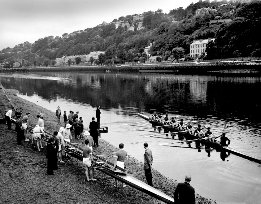
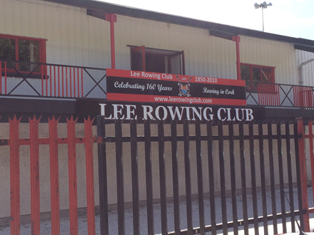
Lee Rowing Club:
The Lee Rowing Club, founded in the 1850s, has had a long and varied history. The club had its initial headquarters near the Cork Corporation yard on Albert Quay, and won the Glenbrook international Rowing Race in 1862.
In 1864 the premises were destroyed by fire and in the early 1870’s the club moved to a new clubhouse and rooms in Lower Glanmire Road and rowed from the rear of the former Ferry Boat Inn.
In 1880 Lee Rowing Club moved to its present site on the banks of the River Lee at the Marina and built a new clubhouse around 1886.
The Lee Rowing Club also changed its name for a span of 18 years in the 1870’s and 1880s to Cork Boat Club but reverted to the name “Lee” again on 25 March 1888.
Not too many people know that the wooden top half of the early twentieth century clubhouse was one of the exhibition halls used in the Cork International Exhibition in 1902. After the exhibition the clever and resourceful club members purchased their favourite exhibition hall and floated it down the river to the Marina. There it was placed on brick walls and made into the upper storey of the clubhouse. Years later when the roof began to leak the oarsmen put a new roof over the old one. The old building has since been replaced with a modern one but with a hint to the old style of the original.
In the early days members of the Drapers’ Club in Cork joined Lee Rowing Club and later on the Drapers’ Club set up and ran what is now the Cork City Sports meeting. The Drapers were also responsible for the setting up of the Lees GAA team, which also included members of Lee Rowing Club in the old days.
READ MORE: Check out Lee Rowing Club’s website, Lee Rowing Club | Just another WordPress site
LISTEN: Richard T Cooke’s song on The Marina
Gunpowder Pier:
Further down from the Lee Rowing Club, walk to the river bank to observe the remains of Gunpowder Pier. It was from here in the late nineteenth century that gunpowder from the mills at Ballincollig was loaded on wooden barges bound for the gunpowder store at Rocky Island in Cork Harbour.
The pier’s location on The Marina was bound up with safety. It was away from the busy Cork’s South Docks area – so if an accidental explosion did occur it was not as lethal to those around.
At the pier at one time, there was a small storehouse and jetty. Over one hundred years ago, it was almost a daily sight to see the two horse drawn covered gunpowder wagon, and painted yellow, making its way down the specially made centre park trackway of the Cork City Park Racecourse to The Marina.
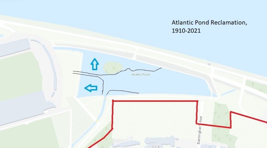
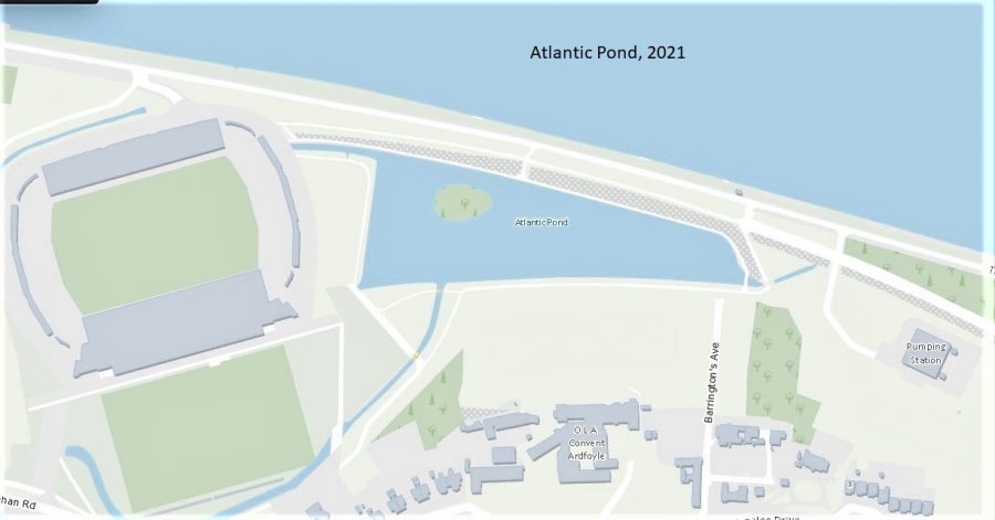
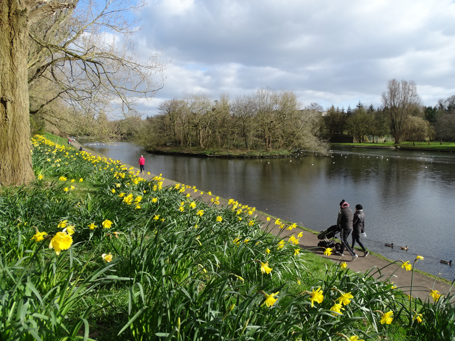
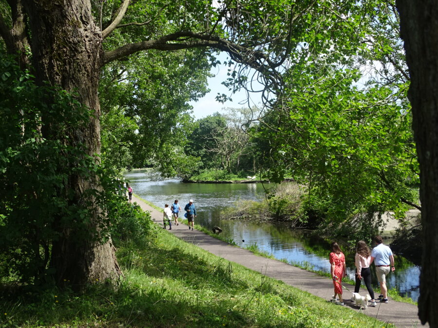
Atlantic Pond:
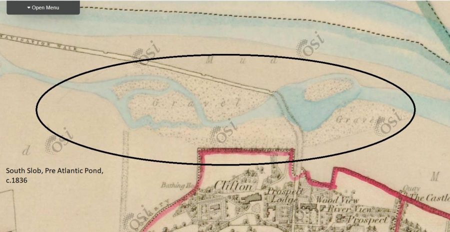
The Atlantic Pond was one of the city’s greatest engineering projects of the nineteenth century . In 1843, Cork Corporation engineer Edward Russell was commissioned to present plans for the reclamation of 230 acres of the city’s south sloblands, The proposed aims were to create an enormous public park and to provide some building ground.
The task proposed was epic as the sloblands undulated and when the tide was in, various areas of the sloblands were covered more so than others with water. Edward Russell’s eventual published plan in December 1843 proposed the extension and widening of the dock like Navigation Wall to create a new walkway. He also proposed to manage the flow of tidal water entering the reclaimed land by installing sluice gates, sluice tunnels, and embankments and creating a giant holding pond.
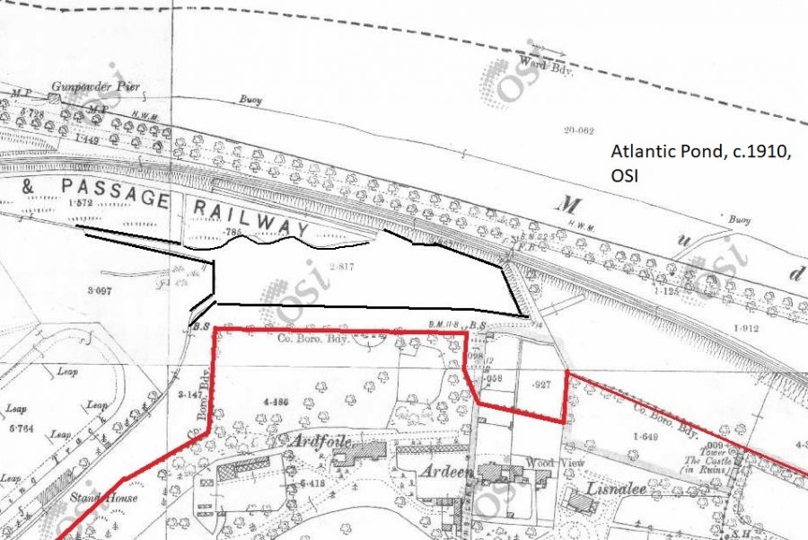
The holding pond was a reservoir of six acres in size with sheeting piles driven in underneath it but above ground was presented as an ornamental pond to the general public. The pond became known as the Atlantic Pond. Comparing an 1840 Ordnance Survey map to a 1910 one shows a significant engineering project.
The pond still possesses its Victorian sluice gates and tunnels to facilitate the drainage and exclusion of water.
The Great Famine and post economic fall-out took away the opportunity for the public park but in 1869 after twenty years of further drainage and land reclamation, business man John Arnott leased the south sloblands from Cork Corporation and it was converted into the Cork City Park Race Course. In 1917 the heart of its space was converted into the Ford Tractor Manufacturing Plant but the central road of the racecourse was retained – Centre Park Road.
The twentieth century also brought extensions to the scale of the Atlantic Pond as further land was secured west of the original pond.
View: Kieran’s short film on the Atlantic Pond:
View a brief nature walk with Jim Wilson at the Atlantic Pond:
Wildlife guide Jim Wilson, walks around the Atlantic Pond in Cork, as a part of the Cork Life Long Learning Festival. 26.03.2013. Video by Des Barry. Irish Examiner.
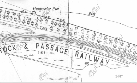
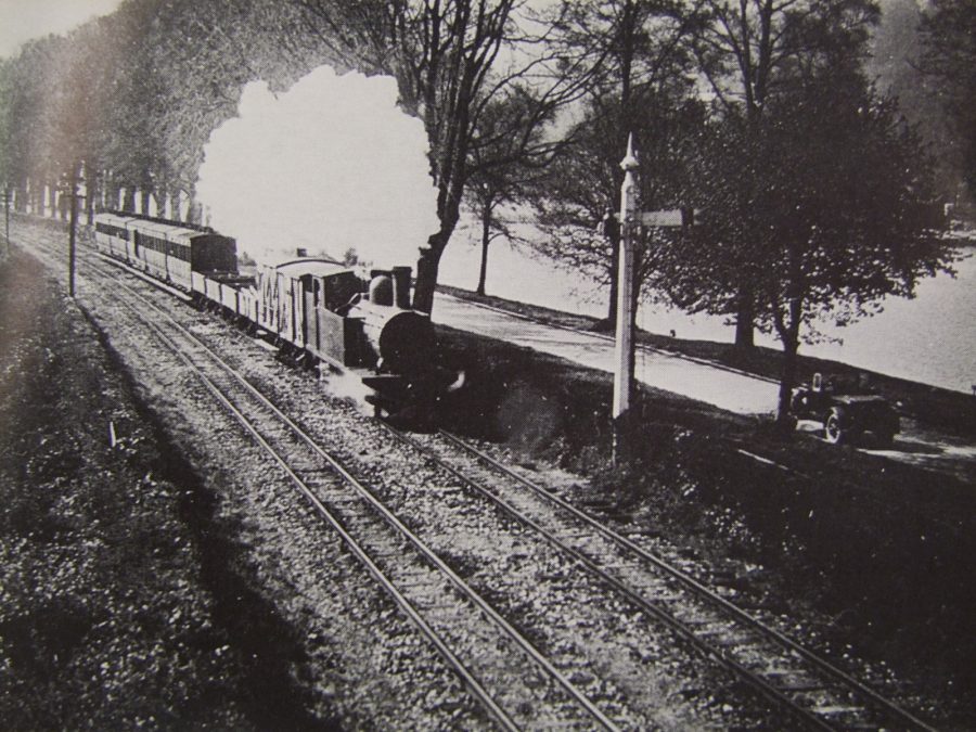
Cork Blackrock and Passage Railway Line:
The age of the railways came to the forefront of the visions of Cork’s growing middle class in the 1830s. In 1836, two years after the construction of Ireland’s first railway between Dublin and Kingstown (Dun Laoghaire), a railway was proposed by several of Cork city’s wealthiest merchants to connect the city to Passage West via Blackrock. Passage West itself was an important minor port town in Cork harbour.
In 1836, lands at Lakelands and Ballinure were surveyed and the engineer, Charles Vignoles, planned the routeway of the railway itself.
In 1837, the Passage Railway Bill was passed in the Westminster Parliament but work only got underway in the late 1840s. By this time, the Cork Passage Railway Company had been reformed into the Cork, Blackrock and Passage Railway Company. Legislation was passed for this company in 1846 and in September of that year, the company’s engineer Sir John MacNeil carried out the relevant survey work.
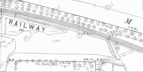
The proposed line would run close to the south of the Navigation Wall (now the site of The Marina) on reclaimed land and remain close to the river all the way Passage West. Work began in June 1847.
Due to the fact that the construction was taking place during the Great Famine, there was no shortage of people looking for work. Some of the most difficult sections were the digging out and gunpowder blasting of the rock by Dundanion and the Blackrock platform.
The entire length of track between Cork and Passage West was in place by April 1850 and within two months, the line was opened for passenger traffic.
The City’s terminus, designed by Sir John Benson, was based on Victoria Quay but due to the creation of the Cork City Park Racecourse in 1869, it was rebuilt and opened in 1873 on Hibernian Road. The old building can still be viewed.
In the late 1800s, the Cork Blackrock and Passage Railway also operated a fleet of river steamers in competition with River Steamer Company (RSC).
By 1932, the increase in the use of motor cars caused a decrease in the use of the line by passengers. Consequently, economic losses forced the line to close.
The oId railway line now hosts a pedestrian walkway where several of the railway platforms can still be viewed, as well as the railway bridges, and the steel viaduct that crossed the Douglas estuary.
For more information, check out the fab work and photographic collection of railway historian Colm Creedon on Cork County Library’s online local history platform, https://www.corklocalstudies.ie/items/show/4272
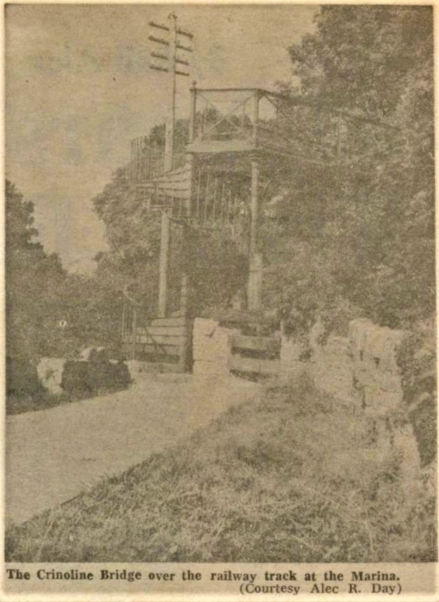
Crinoline Bridge:
All that is left of the Crinoline bridge are the lower stone walls but it once spanned the railway line to allow people to cross safely from the river side to the Atlantic Pond. Built in 1859, it was designed by Sir John Benson, one of the leading architects and engineers of his day. It had a wrought-iron spiral stairs on both sides with a timber platform, 28 feet long and 14 feet 6 inches above the tracks, surrounded by an ornamental trellis.
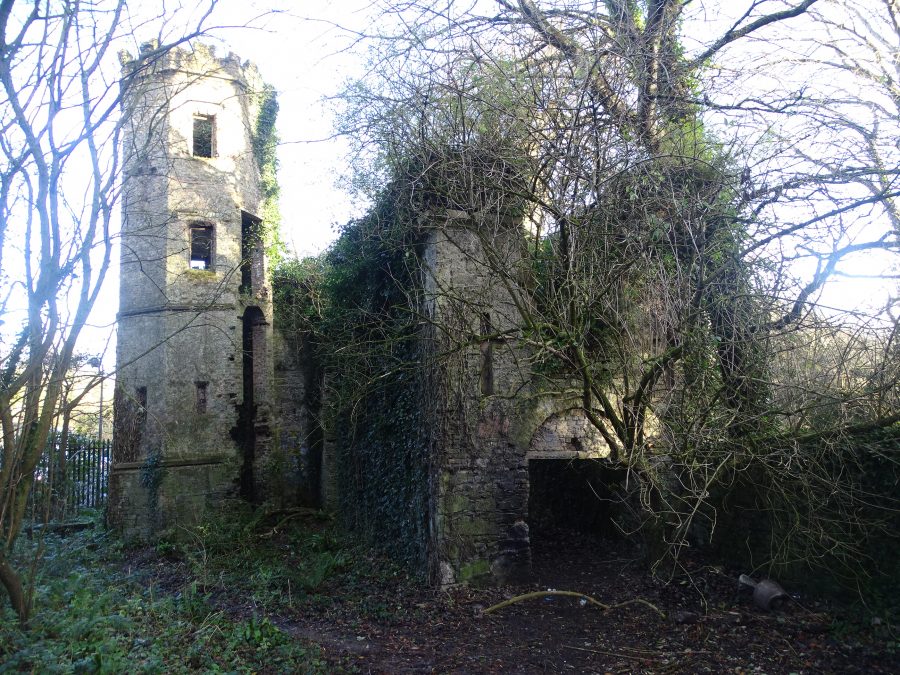
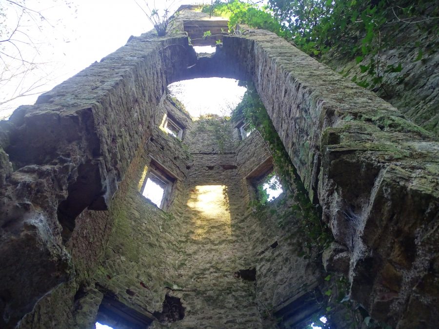
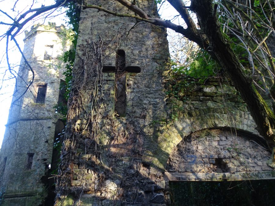
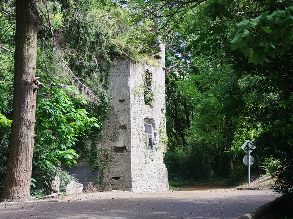
Barrington’s Folly:
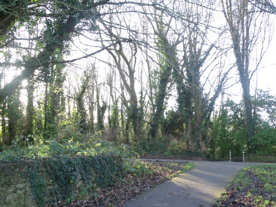
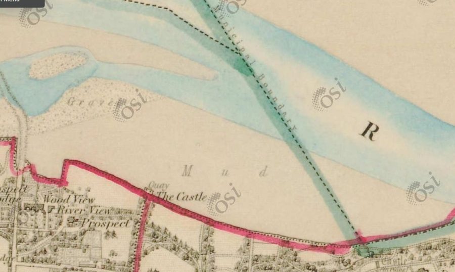
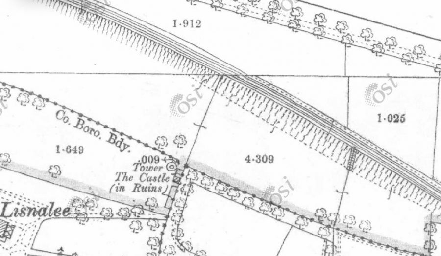
The site of this hidden away and mysterious castle folly dates from the first two decades of the early nineteenth century. It was named after the local family of Barrington. In its day, it was located upon a river bank overlooking estuarine mud and the scenic River Lee. Access to the folly was via Blackrock Road through a laneway on the western side of Rockcliff.
As the nineteenth century progressed, further mud was dumped in front of the folly by the Cork Harbour Commissioners. In time the view of the river was obscured by the trees and vegetation that grew upon the reclaimed sloblands.
The undulating nature of the reclaimed sloblands can clearly be seen today on the river side of the now ruinous folly as can the now overgrown small pier wall area in front of the folly.
The folly was an integral part of a social club headed up by Sir David Perrier, Mayor of Cork in 1814. He lived in Ballinure House, Mahon. He was a glass manufacturer, sugar refiner, paper maker and distiller.
Currently hidden away off the old Railway Line walk, the folly will become a core heritage site to be viewed as part of phase 2 of the Marina Park project.
Eccentricities at Barrington’s Folly:
It is unknown how many years the activity within Barrington’s Folly lasted or how long the social club called the Ballintemple Corporation lasted. Its principal years of activity seem to hover between the 1810s and 1820s and is remembered by historians later in time for the eccentricities of the group.
One event, which The Cork Merchantile Chronicle newspaper of mid July 1814, records is a very insightful notice convening a meeting of Ballintemple Corporation. The meeting was to mark the ancient ceremony of throwing the dart for the following 12 August by the chair but also real life Mayor of Cork David Perrier. Certainly, the group enjoyed their own theatrics at the folly. The notice reads:
“The members of the body corporate of Ballintemple are therefore to assemble at 10 o’clock in high regalia and paraphernalia, gowns, wigs and hoods, maces and other outward signs of wisdom and jurisprudence, and after proceeding in antique form and magisterial dignity, with music, banners, streamers, etc., cause to be recognised their jurisdiction over the slobs, fens. moors, marshes, estuaries, brickeries, fisheries, flukeries, cockleries, dabsands, flounder banks and periwinkle beds in and out of the river Luvius, Hodie, Lee, and all the bays, gulfs, creeks and channels, inlets and outlets thereunto belonging or appertaining, and then feast as becometh in the Great Hall of the Corporation, and till those abroad or beyond the seas or otherwise prevented from a due obedience to this proclamation are, on pain of disfranchisement, to send their attested letters of incapacity as of old established. Done in full Council, at the Council Hall, this 12th July, in the year of safety, 1814, of the Corporation. Timothy Brusnehaune, Town Clerk.”
The glittering regalia paraphernalia was borrowed by a local group of theatre players called the Apollo Society, who had just staged a play called Blue Beard. A large set piece of large elephant of the performance was also borrowed and fixed on one of the folly’s mudboats. The procession along the river and the Navigation Wall was intended as a good-humoured take on Corporation of Cork and and the ancient ceremony of Throwing the Dart.
Cork Main Drainage:
Work started on the city centre section of the £120 million Cork main drainage on 19 April 1999 with the laying of sewerage and drainage pipes along the main streets.
This was part of one of the largest engineering and environmental projects ever undertaken by a local authority in Ireland to comply with new stringent EU regulations.
The scheme included: a new sewer system in the city central island streets that pumped into Horgan’s Quay; this connected to a main trunk sewer on the southern side of the river by a large underwater siphon.
The main trunk sewer was brought from Kennedy Quay to bring wastewater to a new pumping station at a site of Atlantic Pond.
The sewerage was to be pumped from there to a treatment plant site at Carrigrenan at Little Island with an outfall pipeline at Marino Point.
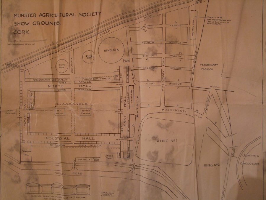
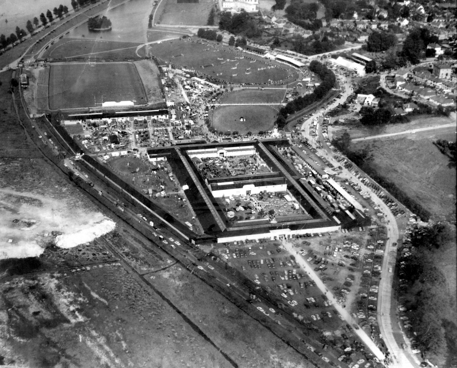
Cork Showgrounds:
On 1 August 1891, at a post show discussion led Mr A Ferguson of the County of Cork Agricultural Society, he proposed that a permanent show yard be erected in a portion of the Cork Park Race Course with grounds 20 acres in extent. Their home up to that point was in temporary and seasonal accommodation behind the Municipal Buildings or what is now Cork City Hall.
The first annual show to be held on the new grounds was held on Thursday and Friday, 7 and 8 July 1892. In the post show discussion, several other ideas were discussed on how to develop the new grounds, in particular developing a cattle ring, a galloping space and a proper system of distributing tickets.
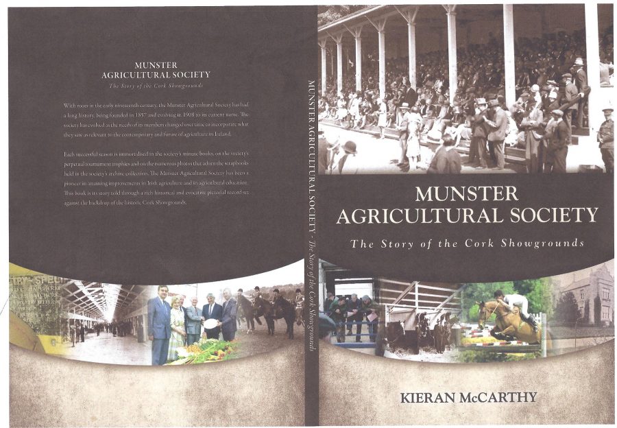
As the County of Cork Agricultural Society developed its new home in the Cork Park Race Course, it was dependent on the success of its shows and the subscriptions and voluntary contributions of its members. To make the society more regional in stature, in 1908 the name of the County of Cork Agricultural Society was changed to the Munster Agricultural Society.
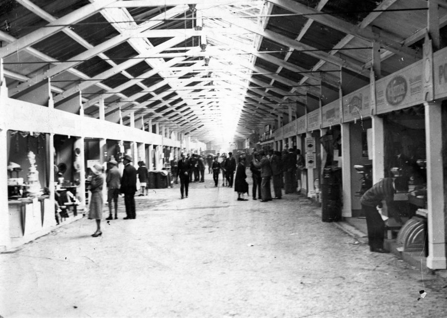
A visit to the annual Cork Summer Show was an annual ritual for many Corkonians. It was so important that many of the city offices would close down for the afternoons of the show so that people could go to the show – it was like a public holiday. It was a sort of social outing where people would come year after year to meet up.
However, as the decades of the late twentieth century progressed the economic recessions forced the drivers of the Irish economy to diversify. Agriculture went through a lot of reform and the show itself started to tail off and was probably a victim of the Celtic Tiger economy and the shift in the economy from agriculture to other industries like pharmaceuticals, the IT sector and the construction sector. The creation of Cork City Council’s South Docklands plan brought further changes to the Munster Agricultural Society.
The Council’s compulsory purchase order indirectly sped up a future plan for the society. In July 2009, for the first time in its history, the Cork Summer Show was held outside the city. A 60-acre site, just off the Ballincollig Bypass, became the new home for the Munster Agricultural Society’s two-day show. This became the new chapter in the proud history of the Munster Agricultural Society.
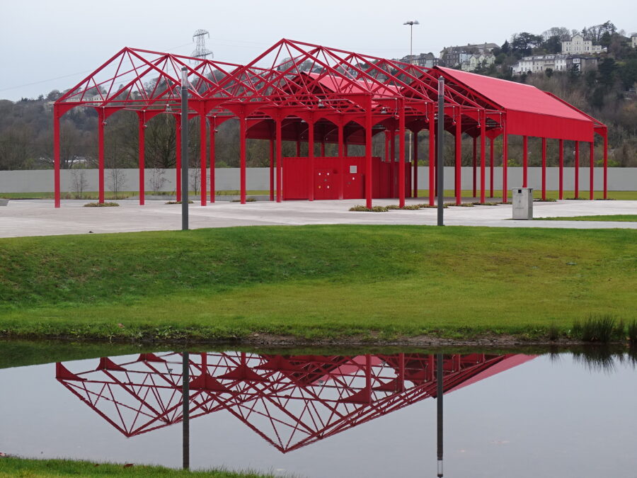
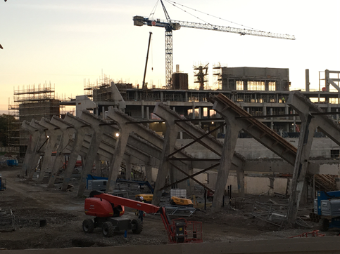
As for the former showgrounds, it is now the site of the new Marina Park – its red pavilion marks the rich history of the showgrounds. The sides of the pavilion reflecting the society’s former buildings will not be enclosed, and there will be possibilities for coffee pods and outdoor seating and arts and crafts. The project is a e.10m investment into the area, of which nearly e.5m came from EU Urban Sustainable Funds, which are part of the EU’s structural funds and are a crucial source of funding for cities
READ MORE: Cork Summer Show Agricultural Show Munster Agricultural Society Cork Agricultural Show Ireland Summer Festival Cork Ireland
View Kieran’s “Opening of Marina Park, Phase 1, 22 May 2022
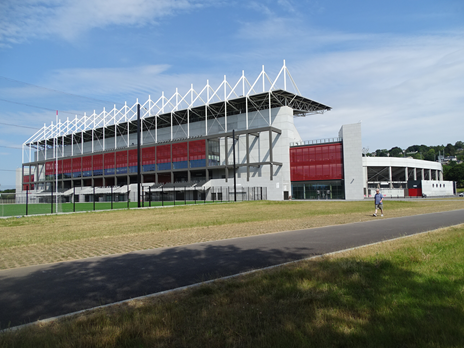
Páirc Uí Chaoimh:
At the time of the GAA’s establishment in 1884, society was responding to its own challenges – a time of continued emigration and economic uncertainty. In Cork, both the butter and beef markets were in decline and the City looked towards political leaders like Charles Stewart Parnell to give voice to the the concerns of citizens in Westminster.
On 1 November 1884, the GAA was formed. The first GAA meeting under its auspices was held in December 1884 in Toames, near Macroom, County Cork. A second meeting to help develop the ideas of the GAA was held in the Victoria Hotel, Cork, on 27 December 1884.
In late 1886 the first Cork County Board was formed with the first County Championship, taking place on 6 March 1887 at Cork City Park Racecourse. The First County Cork Convention took place at the Mechanics Hall, Grattan Street, on 27 December 1887. It was attended by the representatives of 62 Clubs. Gaelic games represented everything Irish and was deemed a hopeful embrace of Irish Nationalism.
From mid-summer 1892, the County of Cork Agricultural Society decided to rent out parts of its new grounds to interested groups – the Gaelic Athletic Association, Cork Cycle Club, Cork Athletic Club, United Football Club, the Irish Automobile Club and the Cork Gun Club.
The Gaelic Athletic Association built its own very small stadium on its rented out land in 1898. The Cork Athletic Grounds, as it was known, opened in 1904 and hosted All Ireland finals, Munster finals and National League games.
In 1972 it was decided to redevelop the Athletic Grounds and additional land was acquired from the Munster Agricultural Society, whose premises adjoined the Athletic Grounds. The new stadium area covered almost 9 acres, with works undertaken by HMC Construction Ltd.
Work began in April 1974, though details of the new stadium “of the most modern design and facilities” were not unveiled until a press conference took place in the Imperial Hotel, Cork on 26 July 1974. The new stadium was estimated to cost approximately £1 million, but ultimately overran to £1.7 million.
Known as Páirc Uí Chaoimh, in commemoration of the late general-secretary of the GAA, Pádraig Ó Caoimh, the stadium was to have a capacity of 50,288. Designed by the Cork city firm of consultant engineers, Horgan and Lynch, Páirc Uí Chaoimh was designed to have seating for 19,688 spectators. it officially opened on 6 June 1976.
In May 2014, the Irish Government sanctioned a €30 million grant to help fund the regeneration of the stadium. The work was due to start in summer 2014, and on 6 July 2014, the stadium hosted its last ever provincial football final.
After over two years of work, which created 500 construction jobs and cost in the region of €80 million, the eyesore of the old concrete bowl has now been replaced by a state-of-the-art arena. With the exception of a few beams in the terracing, the stadium has been rebuilt from scratch.
WATCH: The final views of Pairc Ui Chaoimh , before the the wrecking ball moves in, showing the inside of the stadium, tunnel, dressing rooms, old offices and board room and the old show grounds which will house the new all weather and training pitches Video by Eddie O’Hare.
Watch short news report on the Old Pairc Ui Chaoimh with Marty Morrisey:
Watch a short news documentary on the new Pairc Ui Chaoimh with Alan Quinlan:
Dundanion Castle:
The earliest and official evidence for a settlement in Blackrock dates to c.1564 when the Galway family created what was to become known as Dundanion Castle. Adjacent the ruinous castle is the original slipway, which became known as King’s Dock and is attached to a legend that William Penn used it for his departure point for America in the 1680s. It is overgrown but still present. Its distance from the present River Lee reveals the hard slog involved in reclaiming areas such The Marina and environs from the river. The castle windows are grilled up but its limestone block nature is still impressive.
A diary book survives for Eliza Deane, of Dundanion House, in 1832 in the Cork Archives. Eliza’s husband was the well-known Cork architect, Thomas Deane. Entries for 8-9 March 1832, recount the laying of the first stone of their new house by their ‘beloved son’ Thomas Newenham Deane. The stone was originally the top stone of ‘old Dundanion Castle’. She also mentions stone masons making ‘a ‘picturesque ruin’ of Dundanion Castle.
READ MORE on Eliza Deane: Cork Archives Online Catalogue 5 | Details
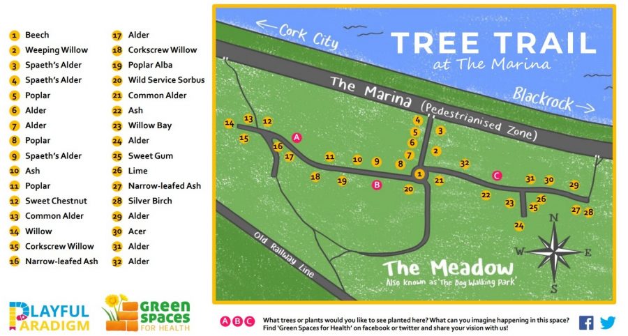
The Marina Meadow:
This park within the Marina park is the host to a Cork Healthy Cities project. They have created a wonderful way to get out in the fresh air with a tree trail adventure. The benefits are numerous – going outdoors, learning to read maps, finding out about how to identify trees, having fun, and not to mention all the benefits for mental health and wellbeing of just being immersed in green, communing with nature.
CLICK HERE for a larger pdf map, Marina-Tree-Trail-Final-print-version.pdf (corkhealthycities.com)
Tivoli:
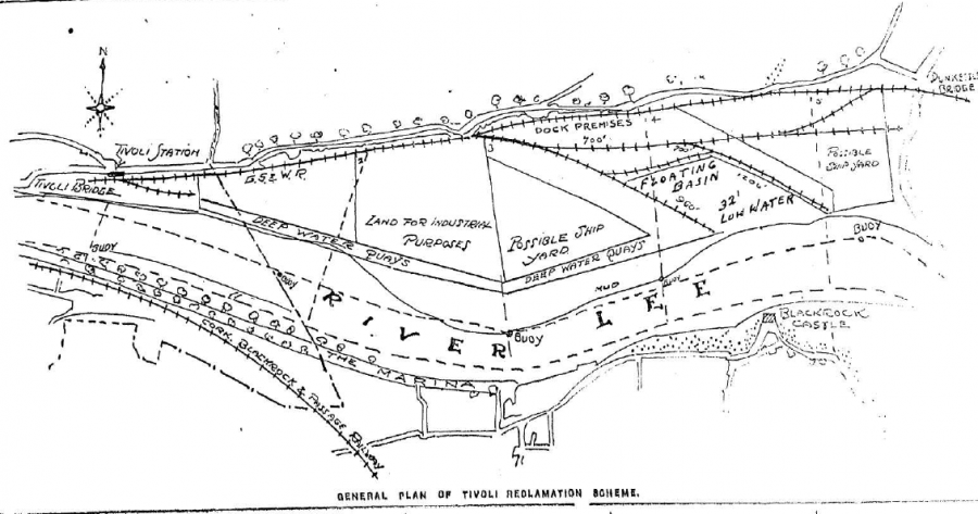
There is something hypnotic about the coming and going of shipping at Tivoli opposite The Marina walk. During and up to the early years of the twentieth century berths were deepened at low water to keep all shipping afloat at lowest tides within the estuary of Cork Harbour. Wharves and deep water quays were also built. In 1919 the Cork Harbour Commissioners acquired from the Board of Trade 153 acres of slobland at Tivoli for the purpose of pumping dredged material ashore, thus creating new land for industrial purposes. The element of reclamation happened over several decades.
In the early 1950s oil storage depots were developed on the site. A further ten acres were made available for development circa 1960.
From 1960, modern Cork Harbour began to emerge, with the construction of oil terminals, steel mills, shipyards, deep water ferry port and industrial bases. The entire concept of transporting general cargo underwent radical changes with the introduction of containerisation. That brought about revolutionary changes in ports such as Cork.
Whereas previously the only requirements of general cargo services were quays and adjoining transit sheds, the ports now had to provide quays with high load-bearing qualities and wide aprons, specialised container cranes, large marshalling areas for containers and further specialised handling machinery within the container compounds.
As the years progressed Tivoli Industrial and Dock Estate created new facilities such as container holding areas, roll-on roll-off and conventional berths, a 30-ton gantry-type container crane, a modern transit shed, a passenger terminal and office block and an extensive paved area for the marshalling of containers and commercial vehicles. Thirty-seven acres were also allocated for general cargo purposes.
Watch short films on the work at Tivoli Docks here and in Cork Harbour:
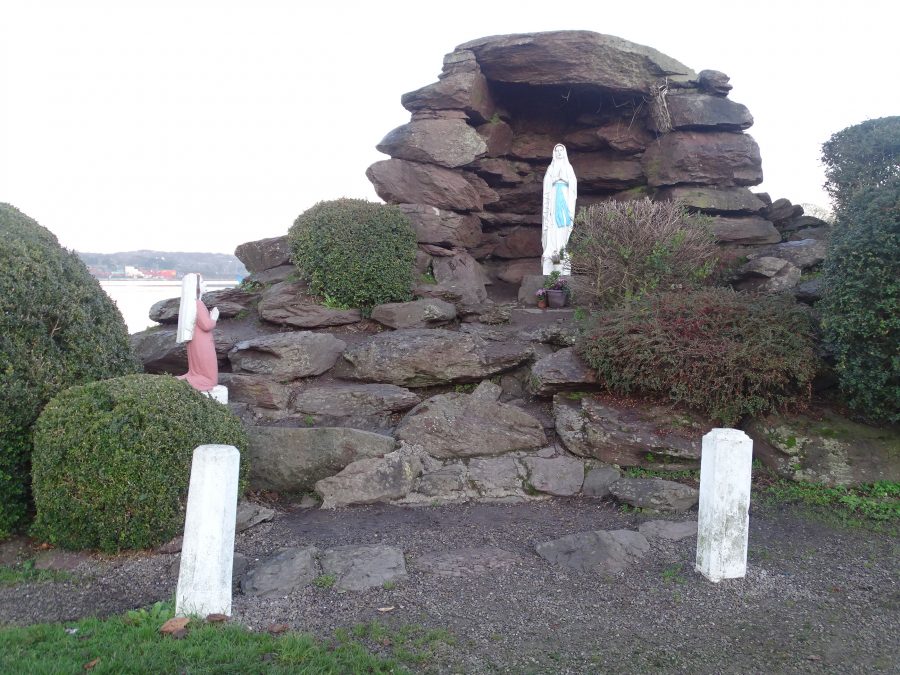
Blackrock Pier Grotto:
On 26 March 1958, a meeting was called in the Blackrock Rowing Club by a group of local people in an effort to erect a local grotto. They invited the various organisations within the parish to attend. As a result, a committee was formed with Michael Sheehan as Chairperson, Breda Kelly as Honorary Secretary and Martha Moynihan as Treasurer. Thirty-five more volunteers made up the group and they duly set about their objective.
A site was acquired at the end of the Marina – just above where the fishermen kept their boats in the winter time. A prominent gardener, Mr Denis Gallagher, was invited to attend one of the meetings and he gave some ideas on what style of Grotto to erect. He designed it and supervised its construction.
Initially, work progressed very speedily. Two lorries were hired at a cost of 20 shillings to aid the construction and the main statue was ordered from Denis McCarthy of White Street. Materials were purchased from William Ellis & Sons. The grotto is constructed of massive red sandstone boulders from Tivoli quarry – the majority of which are three to five tons in weight and faces west, towards the River and the Marina. The statues of Our Lady and St Bernadette are of white Italian marble. A local electrician, Mr J Tobin, completed the flood lighting and the 12 star halo over the Our Lady statue.
On Wednesday 28 September 1960, the Grotto was officially opened and blessed by parish priest Fr Aherne, ably assisted by Fr Cummins and Fr Crowley.
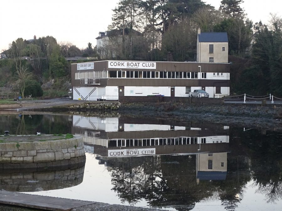
Cork Boat Club:
In August 1898 the Cork Boat Club was founded. Premises were initially leased overlooking the fishery spots in Tivoli. Boats were purchased and on its first outing at Cobh Regatta in 1899 the young club had its first successes. In 1902 at the Cork International Regatta at The Marina a Junior VII was successful against eight other Cork rowing crews. The spectators were so enthralled by this success that a massive collection was taken up and this prompted the committee of the Cork Boat Club to rent the old Coastguard premises at Undercliffe, Blackrock which remains the site of the club’s modern building/ home to the present day.
The Club’s first major success was in 1905 when the Leander Ship Trophy was in play and was won for the first time. This Trophy had been presented in 1904 to Cork’s rowing clubs by the River Thames based and Berkshire based Leander Rowing Club in appreciation for the wonderful hospitality they had received from Cork’s citizens and Cork International Regatta Committee in 1902.
The original Cork Boat Club House was a pavilion from the 1902/3 Cork International Exhibition and housed the club’s boats and equipment until 1939. At that point, the old Coastguard building was converted into dressing rooms and Club rooms and these fronted well laid out gardens and a beautiful lawn on which band promenades every weekend were organised to considerably help club funds. In time, the old building developed into the extensive facility that exists today.
READ MORE: Check out Cork Boat Club’s website, Cork Boat Club
Blackrock Pier:
There has been a formal pier in Blackrock since the early 1700s. The current pier dates to the late nineteenth century.
The history of fishing and fishermen in Blackrock village at least dates back to the early 1600s.
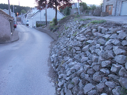
Within the heart of Convent Avenue, there is a historic stone wall, which has always impressed me and which separates higher ground from the avenue itself. Random rubble in its nature, it is imposing and adds to the aesthetics of a once very populous area. Around it lys a series of modern day houses, but amidst these are a series of cottages, their present day paintwork belying their true nature of times gone by.
With more and more British government reports and antiquarian accounts of Ireland, coming online, recently I stumbled across a report from 1843, which focussed on Blackrock Village and helps to reconstruct life there at that time.
The report was entitled the “Physical and Moral Condition of the Working Classes in the Parish of St Michael Blackrock near Cork”. It was read by North Ludlow Beamish, President of the Cork Scientific and Literary Society, before the statistical section of the British Association of the Advancement of Science at Cork in August 1843. The data presented describes the pre-famine world of Blackrock.
Beamish’s paper is full of insights into the area surrounding Convent Avenue. He notes that the population of Blackrock Village and its immediate environs in April 1843 was 2,630 consisting of 557 families living in 413 houses. A total of 61 houses were uninhabited and 9 were in the progress of building. Ninety families were living in one roomed houses, 260 in two rooms and 207 in three or more rooms.
Of the population 2,181 are Roman Catholics and 443 Protestants including dissenters.
The trades Beamish listed were varied; brick makers (numbering 56), cabinet makers (2), carpenters (15), coopers (3), farmers (53), fishermen (111), gardeners (32), horse gingle drivers (13, generally owners), lime burners (18), masons (14), male servants (79), shoemakers (14), slaters (12), smiths (9), tailors (10). Male children numbered 426. As for females, their total was 1133 with 372 employed as servants in work in fields. Female children, aged and infirm numbered 453 whilst 305 were unemployed.
Several fishermen went on to play with the Cork National Hurling and Football club, which was formed in 1886.
Fast forward in time to 1911 and 64 fishermen ranging in age from 14 to 70 years of age are listed in the census as living in Blackrock village. At least 40 are heads of households and had their own dwellings. The men of the sea, Coughlans, O’Learys, Kidneys, John Cashman, Buckleys, Norbergs, Deleas and Ahernes, were all outstanding hurlers. The Coughlans were skilled salmon fishers in the Lee Estuary and owned five or six oar boats specially built for river work. When they weren’t hurling they rowed with Blackrock Boat Club.
The census of 1911 shows a tight knit community with a myriad of occupations – apart from fishermen residents are involved in agricultural labour, shipping, carpentry and smithies. This was a hard working population who strove to provide for their families.
ENDS.
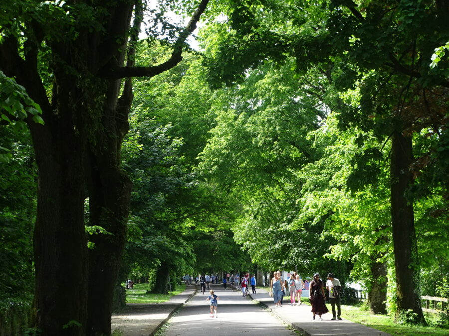
WATCH: Spring at The Marina, Cork, by Kieran McCarthy